- Joined
- 10 Aug 2025
- Messages
- 2,726
- Reaction score
- 2,520
- Country

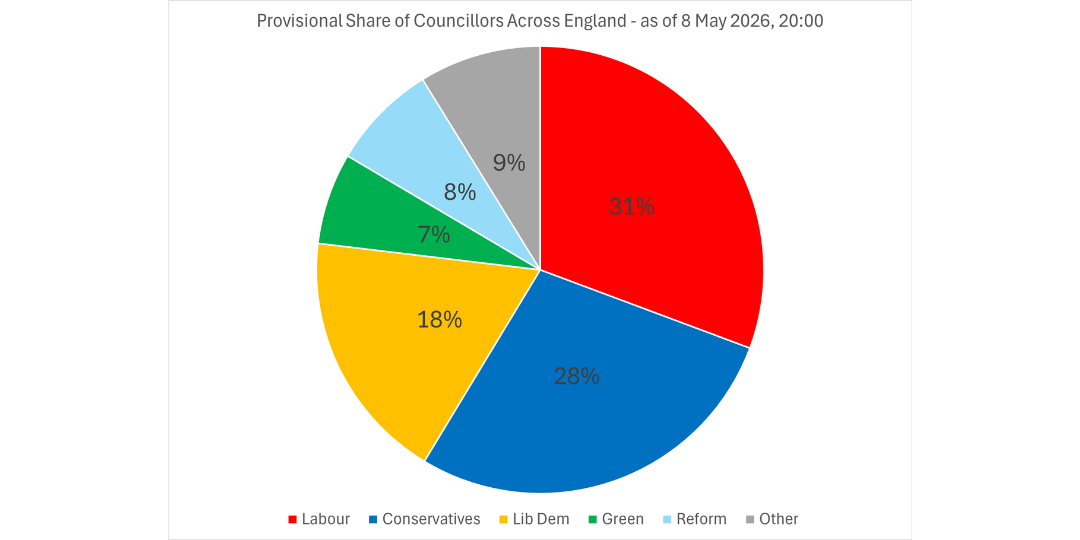
Let's see if you are able to understand this.
The below map shows where there were local elections this year. The turquoise bits are councils which are controlled by Reform Ltd. Anything that is not turquoise are councils which are controlled by a different political party.
View attachment 414539
That is very deceitful Mary. That is a land map, and you are doing the usual lefty trick of ignoring per-capita. For example, there are more people in little Tameside than there are in vast areas of the Scottish Highlands. The reality is that Reform has made record gains and Labour historic losses. Labour has been kicked out of Wales with a giant Welsh boot and a giant wiping of the hands. STOP TRYING TO TRICK PEOPLE MARY, IT IS ABUSE.