Lake Oroville Dam

Joined
24 Sep 2005
Messages
6,345
Reaction score
268
Country
United Kingdom
A good view of the problem - 10/02/17


-0-
 
Sponsored Links
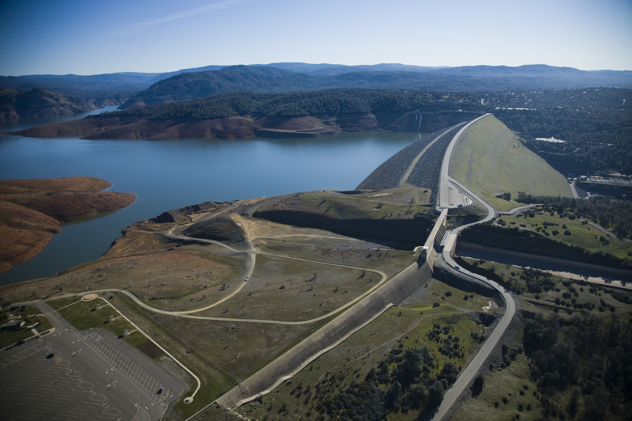
That must be an old video. The emergency spillway has been breached and the cascading water has already devastated a large road section and as soil erosion works its way back to the huge retaining wall the structure will be under mined and weakened and is likely to collapse.
 
This is a view of the Oroville dam which is interesting, the auxillary / emergency overspill wall is clearly built upon relatively solid rather than made up ground.
Willing to bet it is founded in bedrock.

Pix from www.metabunk.org.

6c24126f4b38fe7095e62e3c751d0912.jpg


20170209-150739-q8vaw-jpg.24418


Looks quite docile without water cover providing fears of the unknown hundreds of feet deep n'all - There's a fair bit of wedge involved here.

Apparently there is a 'cofferdam' of concrete some 38 metres (edited from 140) high lakeside of the dam, this was built to protect workings back in the 60's, even successfully endured a major flood around 1964 - well before the main dam was completed - It is incorporated within the lakeside slope.

-----------------------

Graphic from https://www.britannica.com/topic/Oroville-Dam

114534-004-5F1F807A.jpg


https://en.wikipedia.org/wiki/Oroville_Dam

"... In May 1963, workers poured the last of 252,000 cubic yards (193,000 m3) of concrete that comprised the 128 feet (39 m) high cofferdam, which would protect the construction site from floods. This structure would later serve as an impervious core for the completed dam...

...On December 22, 1964, disaster nearly struck when the Feather River, after days of heavy rain, reached a peak flow of 250,000 cubic feet per second (7,100 m3/s) above the Oroville Dam site. The water rose behind the partially completed embankment dam and nearly overtopped it, while a maximum of 157,000 cubic feet per second (4,400 m3/s) poured from the diversion tunnels. This Christmas flood of 1964 was one of the most disastrous floods on record in Northern California, but the incomplete dam was able to reduce the peak flow of the Feather River by nearly 40 percent, averting massive amounts of damage to the area..."


-0-
 
Last edited:
Sponsored Links
Trashed lower part of main spillway - water has gouged a ravine to one side.
Massive debris pile in the pool below spillway, damming flow from power plant circa base of dam - threatened to flood the generating hall.
So the mighty American machine rises from slumbers - set to clearing at least a clear channel through the debris.
Looks pretty well organised given the emergency situation.


-0-
 
As always there's a huge gulf between the situation as described by the media and the reality as understood by engineers.
 
From an aquintance in the USA. "" this was to be expected as the relief channel is smaller than the river feeding the lake. "" That is in terms of cross sectional area when the river is flowing at maximum.
 
Recent video posted here is from California Dept' of Water Resources (DWR).
Although
One of the functions of the reservoir is to act as a buffer for water run off from its approx' 4,000 sq miles catchment area, whilst the dam complex seeks to control the Feather River down stream.

'Blancolirio' (Juan Browne - American Airlines pilot - Adventure motorbiker - etc ) Does quite a good job as amateur reporter - at times he is on the spot.
https://www.youtube.com/channel/UCphqjYZxxzjNbONVmY-0J7Q

-0-
 
Sponsored Links
Back
Top